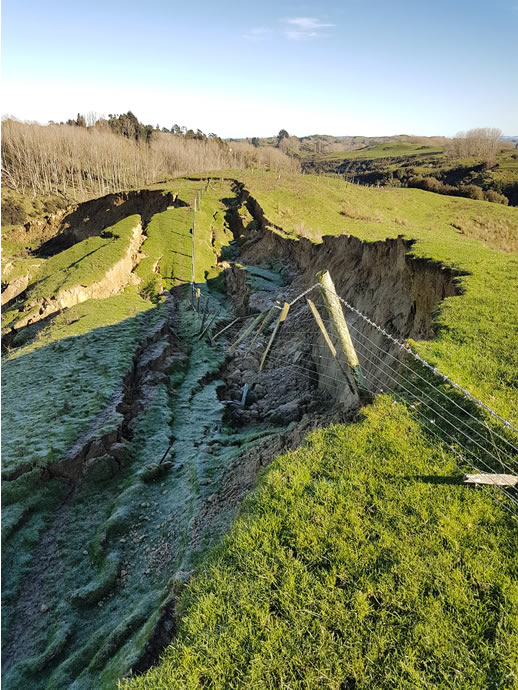
Canterbury researchers and students have mapped 140,000 landslides triggered by Cyclone Gabrielle in a bid to create models for future weather events.
New Zealand now boasts one of the largest single-event inventories of landslides globally.
University of Canterbury (UC) Senior Lecturer and lead researcher Dr Tom Robinson says he was surprised at the sheer number of landslides the researchers found.
In the Esk Valley alone, in just one 12km square area, more than 2000 landslides have been recorded.
Mapping these landslides is critical to future resilience.
“Landslides are difficult to forecast and predict, the only way you can do it is by looking at where they’ve occurred in the past,” Dr Robinson says.
“Mapping tells us the conditions that triggered them in the past: the type of slopes, what is on the land, has rainfall caused it and if so how intense was the rainfall, was it an earthquake, how much shaking was there – all critical information telling us how landslides occur.
“So, when we have a future event, particularly rainfall, we could say this is where we think a landslide is most likely to occur, the predicted trajectory, what’s in its path, and therefore do we need to shut roads, do we need to evacuate people?”
The team uses aerial imagery with up to 30cm high-resolution, imagery so powerful you could spot a laptop on the ground, for mapping.
“We’ve mapped over 140,000 landsides, the smallest roughly the size of a car, from 20 percent of the area affected by Cyclone Gabrielle. We can’t possibly map them all, but we believe there is about 750-850,000 in total.”
Dr Robinson says the change in building and land use regulations can mean our memory of past events is short lived.
“You can go back to Cyclone Bola in the late 1980s and put images side by side, the only thing that has changed is the quality of the imagery,” he says,
“The landslides are in the same place, these have failed before in an extreme event, and they will probably fail again. That’s why it’s so important that we understand where these landslides have occurred so we can avoid them in the future.”
While it was 30 years between Cyclone Bola and Cyclone Gabrielle, the impact of climate change has increased the potential frequency of devastating weather events.
Dr Robinson says they are mapping two types of land movement slides and flows. “A slide is something where the material all moves at once and stays relatively coherent, when you look at where it ends up you can imagine what it originally looked like on the hillside. A slide will also travel a shorter distance and is bigger and deeper, often causing much more damage.
“Flows are chaotic. It all gets mixed up and runs into hollows and divots, following river channels and travelling much further.”
The mapping process is rigorous and has involved hours of training to sharpen the students’ eyes to the attributes and differences of slides and flows.
“We sometimes have 22 different opinions, which makes things interesting” says Dr Robinson
“However, this ensures all future mapping uses the same processes so the models and data can be applied in the future.”
While the work has been extensive Dr Robinson says seeing the knowledge growth in students is highly rewarding.
“This has been an amazing opportunity to build the next generation of leading landslide hazard researchers.”
Dr Robinson has recently received funding from EQC to apply the research to a national landslide risk assessment for residential housing, this work will begin this year.
Source: University of Canterbury


